
Faire un don
Équipez-vous pour votre prochaine aventure :
En tant que Partenaire Amazon, ce site perçoit une commission sur les achats éligibles sans surcoût pour vous.
Carte topographique Canal de Suez
Cliquez sur la carte pour afficher l’altitude.
Faire un don
Équipez-vous pour votre prochaine aventure :
En tant que Partenaire Amazon, ce site perçoit une commission sur les achats éligibles sans surcoût pour vous.
Canal de Suez
Sous le Directoire, les Français envoient plusieurs savants (dont Jacques-Marie Le Père) dès 1798 lors de la Campagne d'Égypte menée par le général Napoléon Bonaparte, dans le but d'étudier s'il serait possible de percer l'isthme de Suez. Dès les années 1820, Linant de Bellefonds et Eugène Mougel Bey, et plus tard Ferdinand de Lesseps, partisans de la doctrine socio-économique du saint-simonisme, avaient déjà envisagé la construction d'un canal reliant la mer Rouge à la Méditerranée. Le projet de canal fut présenté initialement aux Égyptiens en 1833 par Prosper Enfantin, le "père" des saint-simoniens, ingénieur et économiste français, après son exil en Égypte avec ses condisciples, à sa sortie de prison avec quelques-uns de ses disciples. Il effectue de très nombreux relevés topographiques, grâce au soutien de la chambre de commerce de Lyon et d'Arlès-Dufour, un autre saint-simonien qui y est très actif.
Faire un don
Équipez-vous pour votre prochaine aventure :
En tant que Partenaire Amazon, ce site perçoit une commission sur les achats éligibles sans surcoût pour vous.
À propos de cette carte
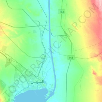
Nom : Carte topographique Canal de Suez, altitude, relief.
Lieu : Canal de Suez, Suez, Égypte (29.92639 32.55958 30.16442 32.58845)
Altitude moyenne : 39 m
Altitude minimum : -3 m
Altitude maximum : 161 m
Faire un don
Équipez-vous pour votre prochaine aventure :
En tant que Partenaire Amazon, ce site perçoit une commission sur les achats éligibles sans surcoût pour vous.