Géolocaliser

Carte topographique Parma

Carte interactive

Cliquez sur la carte pour afficher l’altitude.

À propos de cette carte
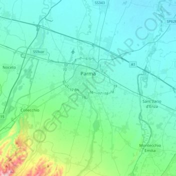
Nom : Carte topographique Parma, altitude, relief.

Lieu : Parma, Emilia-Romagna, Italy (44.66240 10.21481 44.90074 10.44364)

Altitude moyenne : 85 m

Altitude minimum : 23 m

Altitude maximum : 486 m

During World War II, Parma was a strong centre of partisan resistance. The train station and marshalling yards were targets for high altitude bombing by the Allies in the spring of 1944. Much of the Palazzo della Pilotta, situated not far (half a mile) from the train station, was destroyed. Along with it the Teatro Farnese and part of the Biblioteca Palatina were destroyed by Allied bombs; some 21,000 volumes of the library's collection were lost. Several other monuments were also damaged: Palazzo del Giardino, Steccata and San Giovanni churches, Palazzo Ducale, Paganini theater and the monument to Verdi. However, Parma did not see widespread destruction during the war. Parma was liberated from the German occupation (1943–1945) on 26 April 1945 by the partisan resistance and the Brazilian Expeditionary Force.

Wikipedia (CC-BY-SA 3.0)

Autres cartes topographiques

Cliquez sur une carte pour visualiser sa topographie, son altitude et son relief.

Lagrimone

Italy > Emilia-Romagna > Parma

Lagrimone, Tizzano Val Parma, Parma, Emilia-Romagna, 43028, Italy

Altitude moyenne : 720 m

Albareto

Italy > Emilia-Romagna > Parma

Albareto, Parma, Emilia-Romagna, 43051, Italy

Altitude moyenne : 820 m

Lozzola

Italy > Emilia-Romagna > Parma > Berceto

Lozzola, Berceto, Parma, Emilia-Romagna, Italy

Altitude moyenne : 509 m

Monte Penna

Italy > Emilia-Romagna > Parma > Tornolo

Monte Penna, Tornolo, Parma, Emilia-Romagna, Italy

Altitude moyenne : 1 409 m

Borgo Val di Taro

Italy > Emilia-Romagna > Parma

Borgo Val di Taro, Parma, Emilia-Romagna, 43043, Italy

Altitude moyenne : 752 m

Porcigatone

Italy > Emilia-Romagna > Parma > Borgo Val di Taro

Porcigatone, Borgo Val di Taro, Parma, Emilia-Romagna, 43043, Italy

Altitude moyenne : 740 m

Fornovo di Taro

Italy > Emilia-Romagna > Parma

Fornovo di Taro, Parma, Emilia-Romagna, 43045, Italy

Altitude moyenne : 307 m

Vicopò

Italy > Emilia-Romagna > Parma > Parma > Vicopò

Vicopò, Parma, Emilia-Romagna, 43122, Italy

Altitude moyenne : 44 m

Calestano

Italy > Emilia-Romagna > Parma > Calestano

Calestano, Parma, Emilia-Romagna, Italy

Altitude moyenne : 651 m

Bore

Italy > Emilia-Romagna > Parma > Bore

Bore, Parma, Emilia-Romagna, 43030, Italy

Altitude moyenne : 678 m

Marinelli

Italy > Emilia-Romagna > Parma > Parma > Valera

Marinelli, Molinetto, Valera, Parma, Emilia-Romagna, 43125, Italy

Altitude moyenne : 71 m