
Carte topographique Mont Ararat
Carte interactive
Cliquez sur la carte pour afficher l’altitude.
Mont Ararat
Le mont Ararat, en turc Ağrı Dağı ; en arménien Արարատ ; en kurde Çiyayê Agirî), appelé Masis par les Arméniens (Մասիս), les Hellènes (Μασίς) et les Hébreux (מעזיז), est le sommet le plus élevé (5 137 mètres d'altitude) de Turquie (auparavant d'Arménie occidentale).
À propos de cette carte
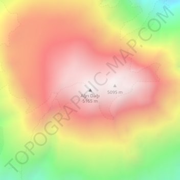
Nom : Carte topographique Mont Ararat, altitude, relief.
Altitude moyenne : 4 582 m
Altitude minimum : 3 780 m
Altitude maximum : 5 111 m