
Carte topographique Mukut Parbat
Carte interactive
Cliquez sur la carte pour afficher l’altitude.
À propos de cette carte
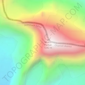
Nom : Carte topographique Mukut Parbat, altitude, relief.
Lieu : Mukut Parbat, Chamoli, Uttarakhand, Inde (30.94981 79.56569 30.94991 79.56579)
Altitude moyenne : 6 272 m
Altitude minimum : 5 574 m
Altitude maximum : 7 177 m
Autres cartes topographiques
Cliquez sur une carte pour visualiser sa topographie, son altitude et son relief.
Pattiyonwāla
Inde > Uttarakhand > Pattiyonwāla
Pattiyonwāla, Dehra Dūn, Dehradun, Uttarakhand, 248171, Inde
Altitude moyenne : 618 m
Tehri-Garhwal
Tehri-Garhwal, Tehri Garhwal, Uttarakhand, Inde
Altitude moyenne : 2 311 m