
Carte topographique Bagmati River
Carte interactive
Cliquez sur la carte pour afficher l’altitude.
À propos de cette carte
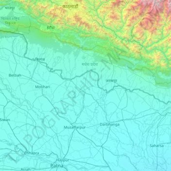
Nom : Carte topographique Bagmati River, altitude, relief.
Lieu : Bagmati River, Muzaffarpur, Bihar, 843321, Inde (25.53594 85.23161 27.78393 86.72235)
Altitude moyenne : 422 m
Altitude minimum : 32 m
Altitude maximum : 6 590 m
Autres cartes topographiques
Cliquez sur une carte pour visualiser sa topographie, son altitude et son relief.