
Carte topographique Eastern Ghats
Carte interactive
Cliquez sur la carte pour afficher l’altitude.
À propos de cette carte
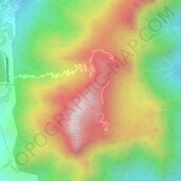
Nom : Carte topographique Eastern Ghats, altitude, relief.
Lieu : Eastern Ghats, Burakhat, Ramagiri, Gajapati, Odisha, India (18.97015 84.36691 18.97025 84.36701)
Altitude moyenne : 1 130 m
Altitude minimum : 777 m
Altitude maximum : 1 494 m
The Maliya Range is located in the northern portion of the Eastern Ghats. The Maliya Range generally ranges between elevations of 900–1200 m, although some of its summits soar higher. The tallest peak in this range is Mahendragiri (1,501 m).[6]