
Carte topographique Toot Baldon
Carte interactive
Cliquez sur la carte pour afficher l’altitude.
À propos de cette carte
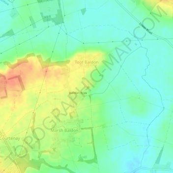
Nom : Carte topographique Toot Baldon, altitude, relief.
Altitude moyenne : 73 m
Altitude minimum : 57 m
Altitude maximum : 99 m
Autres cartes topographiques
Cliquez sur une carte pour visualiser sa topographie, son altitude et son relief.
Baldon Row
United Kingdom > England > Oxfordshire > South Oxfordshire > Toot Baldon
Baldon Row, Toot Baldon, South Oxfordshire, Oxfordshire, England, OX44 9NE, United Kingdom
Altitude moyenne : 73 m