
Carte topographique Dankuni
Carte interactive
Cliquez sur la carte pour afficher l’altitude.
Dankuni
Located at an elevation of None meters (0 feet) above sea level, city's yearly temperature is 30.28°C (86.5°F) and it is 4.31% higher than India's averages. Dankuni typically receives about 150.21 millimeters (5.91 inches) of precipitation and has 150.54 rainy days (41.24% of the time) annually.
À propos de cette carte
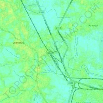
Nom : Carte topographique Dankuni, altitude, relief.
Lieu : Dankuni, Chanditala - II, Hooghly, West Bengal, 712311, India (22.64209 88.25074 22.72209 88.33074)
Altitude moyenne : 6 m
Altitude minimum : 0 m
Altitude maximum : 11 m