
Carte topographique Prescott
Carte interactive
Cliquez sur la carte pour afficher l’altitude.
Prescott
Prescott is in the Bradshaw Mountains of central Arizona, at an elevation of 5,400 feet (1,600 m). The city has a Mediterranean climate (Köppen Csa); however, unlike most other locations in this climate class, there is a pronounced summer wet season due to the North American Monsoon.
À propos de cette carte
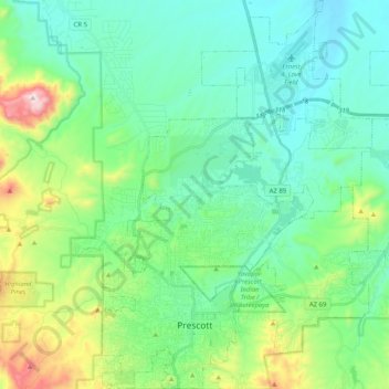
Nom : Carte topographique Prescott, altitude, relief.
Altitude moyenne : 1 674 m
Altitude minimum : 1 486 m
Altitude maximum : 2 302 m