
Carte topographique Mentone
Carte interactive
Cliquez sur la carte pour afficher l’altitude.
À propos de cette carte
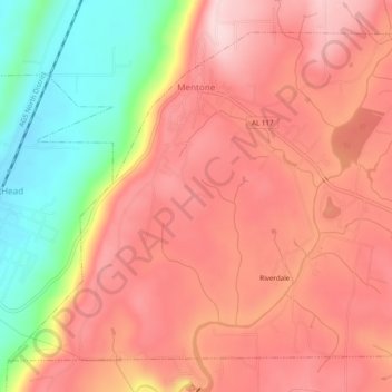
Nom : Carte topographique Mentone, altitude, relief.
Lieu : Mentone, DeKalb County, Alabama, 35984, United States (34.55162 -85.61387 34.58513 -85.56532)
Altitude moyenne : 470 m
Altitude minimum : 307 m
Altitude maximum : 566 m
Mentone is a town in DeKalb County, Alabama, United States. Mentone, located atop Lookout Mountain, has the highest elevation of any incorporated town in Alabama, and narrowly higher than Hytop.