
Carte topographique Radegast
Carte interactive
Cliquez sur la carte pour afficher l’altitude.
À propos de cette carte
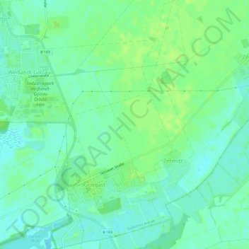
Nom : Carte topographique Radegast, altitude, relief.
Altitude moyenne : 83 m
Altitude minimum : 77 m
Altitude maximum : 89 m
Autres cartes topographiques
Cliquez sur une carte pour visualiser sa topographie, son altitude et son relief.
Prosigk
Deutschland > Sachsen-Anhalt > Südliches Anhalt
Prosigk, Südliches Anhalt, Anhalt-Bitterfeld, Sachsen-Anhalt, 06369, Deutschland
Altitude moyenne : 86 m
Fuhne
Deutschland > Sachsen-Anhalt > Südliches Anhalt
Fuhne, Südliches Anhalt, Anhalt-Bitterfeld, Sachsen-Anhalt, Deutschland
Altitude moyenne : 83 m