

Carte topographique Fishcross
Cliquez sur la carte pour afficher l’altitude.
À propos de cette carte
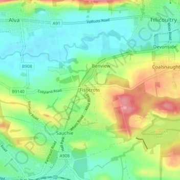
Nom : Carte topographique Fishcross, altitude, relief.
Altitude moyenne : 38 m
Altitude minimum : 7 m
Altitude maximum : 97 m
Autres cartes topographiques
Cliquez sur une carte pour visualiser sa topographie, son altitude et son relief.


River Devon
United Kingdom > Scotland > Clackmannanshire > Tillicoultry
The source of the river is Blairdenon Hill in the Ochils at an altitude of 1,800 feet (550 m). Upper areas have been dammed, creating Upper Glendevon, Lower Glendevon and Castlehill reservoirs. The Devon then flows east and southeast through Glendevon, turning southwest at Crook of Devon and then continuing…
Altitude moyenne : 96 m