
Carte topographique Hüttigweiler
Carte interactive
Cliquez sur la carte pour afficher l’altitude.
À propos de cette carte
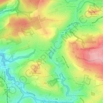
Nom : Carte topographique Hüttigweiler, altitude, relief.
Altitude moyenne : 317 m
Altitude minimum : 255 m
Altitude maximum : 390 m
Autres cartes topographiques
Cliquez sur une carte pour visualiser sa topographie, son altitude et son relief.
66557
Deutschland > Saarland > Landkreis Neunkirchen > Illingen
66557, Illingen, Landkreis Neunkirchen, Saarland, Deutschland
Altitude moyenne : 295 m