
Carte topographique Ludwigsfeld
Carte interactive
Cliquez sur la carte pour afficher l’altitude.
À propos de cette carte
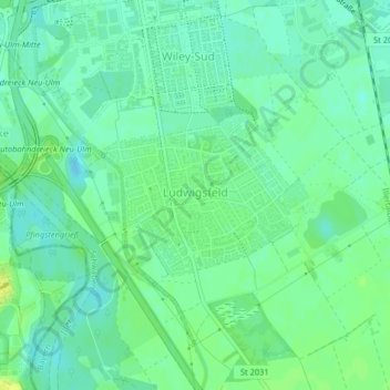
Nom : Carte topographique Ludwigsfeld, altitude, relief.
Altitude moyenne : 477 m
Altitude minimum : 470 m
Altitude maximum : 486 m
Autres cartes topographiques
Cliquez sur une carte pour visualiser sa topographie, son altitude et son relief.
Stadtmitte
Deutschland > Bayern > Neu-Ulm
Stadtmitte, Neu-Ulm, Landkreis Neu-Ulm, Schwaben, Bayern, Deutschland
Altitude moyenne : 477 m