
Carte topographique Баярка
Carte interactive
Cliquez sur la carte pour afficher l’altitude.
À propos de cette carte
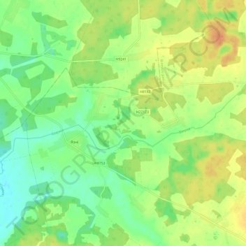
Nom : Carte topographique Баярка, altitude, relief.
Altitude moyenne : 178 m
Altitude minimum : 161 m
Altitude maximum : 196 m
Autres cartes topographiques
Cliquez sur une carte pour visualiser sa topographie, son altitude et son relief.
Габитация
Беларусь > Минская область > Вилейский район > Долгиновский сельский Совет
Габитация, Долгиновский сельский Совет, Вилейский район, Минская область, Беларусь
Altitude moyenne : 182 m