
Carte topographique Loch Morar
Cliquez sur la carte pour afficher l’altitude.
Loch Morar
Loch Morar (Scottish Gaelic: Loch Mòrair) is a freshwater loch in Lochaber, Highland, Scotland. It is the fifth-largest loch by surface area in Scotland, at 26.7 km2 (10.3 sq mi), and the deepest freshwater body in the British Isles with a maximum depth of 310 m (1,017 ft). The loch was created by glacial action around 10,000 years ago, and has a surface elevation of 9 metres (30 ft) above sea level. It separates the traditional district of North Morar (which contains the village of Morar), from Arisaig and Moidart.
À propos de cette carte
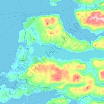
Nom : Carte topographique Loch Morar, altitude, relief.
Lieu : Loch Morar, Morar, Highland, Scotland, United Kingdom (56.94133 -5.80966 56.97220 -5.50604)
Altitude moyenne : 118 m
Altitude minimum : -1 m
Altitude maximum : 780 m
Autres cartes topographiques
Cliquez sur une carte pour visualiser sa topographie, son altitude et son relief.