
Carte topographique Clyde Hill
Carte interactive
Cliquez sur la carte pour afficher l’altitude.
Clyde Hill
The top elevation is close to 375 feet. There are approximately 21 miles of public roadway that make Clyde Hill very centrally located within the Seattle - Bellevue metro area.
À propos de cette carte
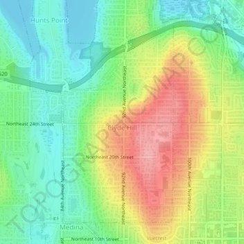
Nom : Carte topographique Clyde Hill, altitude, relief.
Altitude moyenne : 48 m
Altitude minimum : 0 m
Altitude maximum : 118 m