
Faire un don
Équipez-vous pour votre prochaine aventure :
En tant que Partenaire Amazon, ce site perçoit une commission sur les achats éligibles sans surcoût pour vous.
Carte topographique Middle Island
Cliquez sur la carte pour afficher l’altitude.
Faire un don
Équipez-vous pour votre prochaine aventure :
En tant que Partenaire Amazon, ce site perçoit une commission sur les achats éligibles sans surcoût pour vous.
Middle Island
On October 27, 1910, the International Aviation Tournament was held at the Belmont Park racetrack in Elmont, New York. The meet offered $3,750 for the highest altitude, another $1,000 for a world record and a $5,000 bonus for exceeding 10,000 feet. Ralph Johnstone set a new American flight altitude record of 8,471 feet. During the flight, a gust of wind forced him to fly backwards, and he landed near Artist Lake.
Faire un don
Équipez-vous pour votre prochaine aventure :
En tant que Partenaire Amazon, ce site perçoit une commission sur les achats éligibles sans surcoût pour vous.
À propos de cette carte
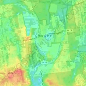
Nom : Carte topographique Middle Island, altitude, relief.
Altitude moyenne : 31 m
Altitude minimum : 10 m
Altitude maximum : 63 m
Faire un don
Équipez-vous pour votre prochaine aventure :
En tant que Partenaire Amazon, ce site perçoit une commission sur les achats éligibles sans surcoût pour vous.