
Carte topographique Pix Brook
Cliquez sur la carte pour afficher l’altitude.
À propos de cette carte
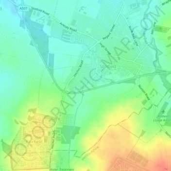
Nom : Carte topographique Pix Brook, altitude, relief.
Altitude moyenne : 56 m
Altitude minimum : 38 m
Altitude maximum : 86 m
Autres cartes topographiques
Cliquez sur une carte pour visualiser sa topographie, son altitude et son relief.