
Carte topographique Криничненское сельское поселение
Carte interactive
Cliquez sur la carte pour afficher l’altitude.
À propos de cette carte
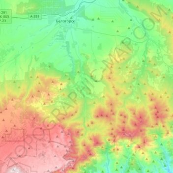
Nom : Carte topographique Криничненское сельское поселение, altitude, relief.
Lieu : Криничненское сельское поселение, Белогорский район, Украина (44.84245 34.54769 45.08789 34.71102)
Altitude moyenne : 485 m
Altitude minimum : 77 m
Altitude maximum : 1 218 m