
Carte topographique Sancreed
Cliquez sur la carte pour afficher l’altitude.
À propos de cette carte
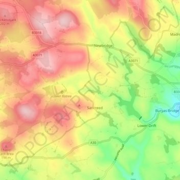
Nom : Carte topographique Sancreed, altitude, relief.
Lieu : Sancreed, Cornwall, England, United Kingdom (50.08360 -5.65062 50.14434 -5.57894)
Altitude moyenne : 134 m
Altitude minimum : 26 m
Altitude maximum : 223 m
Autres cartes topographiques
Cliquez sur une carte pour visualiser sa topographie, son altitude et son relief.