
Carte topographique Strefford
Cliquez sur la carte pour afficher l’altitude.
Strefford
It lies in the civil parish of Wistanstow and is situated just off the A49 road, 2 miles (3.2 km) north of the small town of Craven Arms. The nearest settlement is Upper Affcot, a hamlet located north of the A49, with a public house. Strefford is situated at an elevation between 130 metres (430 ft) and 135m, and just to the east is Strefford Wood, which is at the southern end of Wenlock Edge; the bridleway that runs along the Edge ends just outside the hamlet.
À propos de cette carte
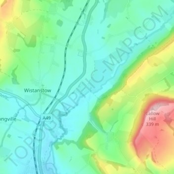
Nom : Carte topographique Strefford, altitude, relief.
Altitude moyenne : 175 m
Altitude minimum : 118 m
Altitude maximum : 335 m
Autres cartes topographiques
Cliquez sur une carte pour visualiser sa topographie, son altitude et son relief.