
Carte topographique 白沙洲乡
Carte interactive
Cliquez sur la carte pour afficher l’altitude.
À propos de cette carte
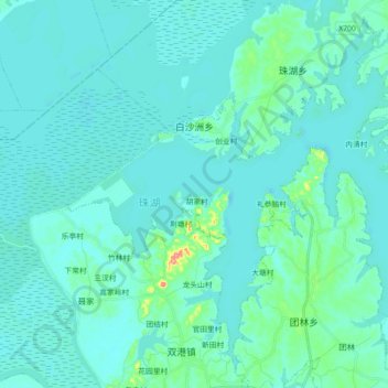
Nom : Carte topographique 白沙洲乡, altitude, relief.
Lieu : 白沙洲乡, 鄱阳县, 上饶市, 江西省, 中国 (29.06441 116.56770 29.20835 116.74729)
Altitude moyenne : 17 m
Altitude minimum : 6 m
Altitude maximum : 106 m
Autres cartes topographiques
Cliquez sur une carte pour visualiser sa topographie, son altitude et son relief.