
Carte topographique Ditchling
Cliquez sur la carte pour afficher l’altitude.
À propos de cette carte
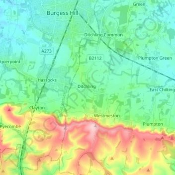
Nom : Carte topographique Ditchling, altitude, relief.
Lieu : Ditchling, Lewes, East Sussex, England, United Kingdom (50.87722 -0.13587 50.96365 -0.08734)
Altitude moyenne : 84 m
Altitude minimum : 19 m
Altitude maximum : 252 m
Autres cartes topographiques
Cliquez sur une carte pour visualiser sa topographie, son altitude et son relief.
Ditchling Beacon
United Kingdom > England > East Sussex > Lewes
Ditchling Beacon is the highest point in East Sussex, England, with an elevation of 248 m (814 ft). It is south of Ditchling and to the north-east of Brighton. It is a large chalk hill with a particularly steep northern face, covered with open grassland and sheep-grazing areas. It is the third-highest point on…
Altitude moyenne : 144 m
Kingston Near Lewes
United Kingdom > England > East Sussex > Lewes > Kingston Near Lewes
Altitude moyenne : 65 m
South Heighton
United Kingdom > England > East Sussex > Lewes > South Heighton
Altitude moyenne : 37 m