
Carte topographique Town of Delafield
Carte interactive
Cliquez sur la carte pour afficher l’altitude.
À propos de cette carte
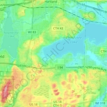
Nom : Carte topographique Town of Delafield, altitude, relief.
Lieu : Town of Delafield, Waukesha County, Wisconsin, United States (43.01736 -88.42293 43.10602 -88.30190)
Altitude moyenne : 291 m
Altitude minimum : 257 m
Altitude maximum : 369 m