
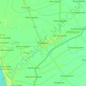
Carte topographique Challapalli
Carte interactive
Cliquez sur la carte pour afficher l’altitude.
À propos de cette carte
Nom : Carte topographique Challapalli, altitude, relief.
Altitude moyenne : 8 m
Altitude minimum : 1 m
Altitude maximum : 13 m
Challapalli is located at 16°07′00″N 80°56′00″E / 16.1167°N 80.9333°E / 16.1167; 80.9333. It has an average elevation of 7 metres (23 ft). It is located 25 kilometres (16 mi) from the district headquarters, Machilipatnam, and lies on the border of the Krishna District and the Guntur District near Repalle, in the South Guntur District.
Autres cartes topographiques
Cliquez sur une carte pour visualiser sa topographie, son altitude et son relief.
Ramanagaram
India > Andhra Pradesh > Challapalle
Ramanagaram, Challapalle, Krishna District, Andhra Pradesh, 521126, India
Altitude moyenne : 8 m