
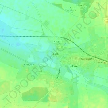
Carte topographique Burg Loburg
Carte interactive
Cliquez sur la carte pour afficher l’altitude.
À propos de cette carte
Nom : Carte topographique Burg Loburg, altitude, relief.
Altitude moyenne : 77 m
Altitude minimum : 68 m
Altitude maximum : 86 m
Autres cartes topographiques
Cliquez sur une carte pour visualiser sa topographie, son altitude et son relief.
Friedensau
Deutschland > Sachsen-Anhalt > Möckern > Friedensau
Friedensau, Möckern, Jerichower Land, Sachsen-Anhalt, Deutschland
Altitude moyenne : 62 m
Büden
Deutschland > Sachsen-Anhalt > Möckern > Büden
Büden, Möckern, Jerichower Land, Sachsen-Anhalt, Deutschland
Altitude moyenne : 61 m
Grabow
Deutschland > Sachsen-Anhalt > Möckern > Grabow
Grabow, Möckern, Jerichower Land, Sachsen-Anhalt, Deutschland
Altitude moyenne : 60 m