Géolocaliser

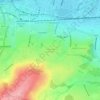
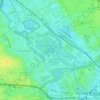
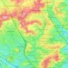
Carte topographique One Tree Close

Cliquez sur la carte pour afficher l’altitude.

À propos de cette carte

Nom : Carte topographique One Tree Close, altitude, relief.

Lieu : One Tree Close, Nunhead, London Borough of Southwark, London, Greater London, England, SE23 3QZ, United Kingdom (51.45049 -0.05230 51.45059 -0.05220)

Altitude moyenne : 43 m

Altitude minimum : 10 m

Altitude maximum : 105 m

Autres cartes topographiques

Cliquez sur une carte pour visualiser sa topographie, son altitude et son relief.
London

United Kingdom > England > London

Altitude moyenne : 77 m

Plumstead Common

United Kingdom > England > London

Altitude moyenne : 44 m

Hampstead Heath

United Kingdom > England > London

Altitude moyenne : 94 m

Hackney Marshes

United Kingdom > England > London

Altitude moyenne : 10 m

Pool River

United Kingdom > England > London

Altitude moyenne : 36 m

London

United Kingdom > England > London

Altitude moyenne : 21 m

Soho Square

United Kingdom > England > London > Islington

Altitude moyenne : 28 m

Kensington Gardens

United Kingdom > England > London

Altitude moyenne : 25 m

Hampstead No. 1 Pond

United Kingdom > England > London

Altitude moyenne : 81 m

Harmondsworth Moor

United Kingdom > England > London

Altitude moyenne : 26 m

Équipez-vous pour votre prochaine aventure :

🧴Crèmes solaires outdoor - Protection UV pour activités prolongées
🧼Savons biodégradables - Hygiène respectueuse de l’environnement
🧤Gants outdoor - Protection thermique pour mains
🔦Lampe Frontale - Éclairage puissant pour vos marches nocturnes ou le camping.
🪢Cordes et paracordes - Cordages multifonctions pour bivouac

En tant que Partenaire Amazon, ce site perçoit une commission sur les achats éligibles sans surcoût pour vous.