
Carte topographique Cusseta
Carte interactive
Cliquez sur la carte pour afficher l’altitude.
À propos de cette carte
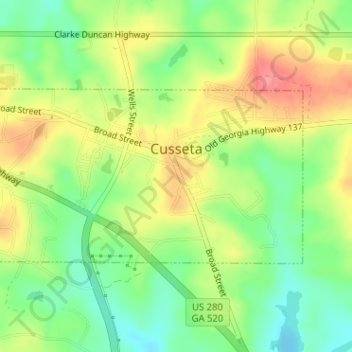
Nom : Carte topographique Cusseta, altitude, relief.
Lieu : Cusseta, Chattahoochee County, Georgia, United States (32.29659 -84.79168 32.31001 -84.76123)
Altitude moyenne : 143 m
Altitude minimum : 103 m
Altitude maximum : 190 m
Autres cartes topographiques
Cliquez sur une carte pour visualiser sa topographie, son altitude et son relief.
Fort Benning
United States > Georgia > Chattahoochee County > Chattahoochee County
Fort Benning, Chattahoochee County, Georgia, 31905, United States
Altitude moyenne : 95 m
Montgomery Hill
United States > Georgia > Chattahoochee County > Chattahoochee County
Montgomery Hill, Chattahoochee County, Georgia, United States
Altitude moyenne : 96 m
Chattahoochee County
United States > Georgia > Chattahoochee County
Chattahoochee County, Georgia, United States
Altitude moyenne : 123 m