
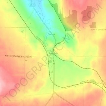
Carte topographique Rock Glen
Carte interactive
Cliquez sur la carte pour afficher l’altitude.
À propos de cette carte
Nom : Carte topographique Rock Glen, altitude, relief.
Altitude moyenne : 426 m
Altitude minimum : 332 m
Altitude maximum : 492 m
Autres cartes topographiques
Cliquez sur une carte pour visualiser sa topographie, son altitude et son relief.
Village of Castile
United States > New York > Wyoming County
Village of Castile, Town of Castile, Wyoming County, New York, United States
Altitude moyenne : 420 m
Java Center
United States > New York > Wyoming County
Java Center, Town of Java, Wyoming County, New York, 14082, United States
Altitude moyenne : 471 m
Town of Middlebury
United States > New York > Wyoming County
Town of Middlebury, Wyoming County, New York, United States
Altitude moyenne : 401 m
Town of Covington
United States > New York > Wyoming County
Town of Covington, Wyoming County, New York, United States
Altitude moyenne : 348 m