
Carte topographique Devil's Punch Bowl
Carte interactive
Cliquez sur la carte pour afficher l’altitude.
À propos de cette carte
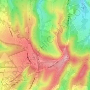
Nom : Carte topographique Devil's Punch Bowl, altitude, relief.
Altitude moyenne : 207 m
Altitude minimum : 120 m
Altitude maximum : 273 m
Autres cartes topographiques
Cliquez sur une carte pour visualiser sa topographie, son altitude et son relief.
Upper Hale
United Kingdom > England > Waverley > Upper Hale
Upper Hale, Waverley, Surrey, South East, England, GU9 0PB, United Kingdom
Altitude moyenne : 118 m
Pitch Hill
United Kingdom > England > Waverley
Pitch Hill, Waverley, Surrey, South East, England, GU6 7NN, United Kingdom
Altitude moyenne : 165 m