Géolocaliser

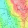
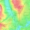
Carte topographique Ryton

Cliquez sur la carte pour afficher l’altitude.

À propos de cette carte

Nom : Carte topographique Ryton, altitude, relief.

Lieu : Ryton, Gateshead, Tyne and Wear, North East, England, United Kingdom (54.96586 -1.78249 54.97871 -1.74462)

Altitude moyenne : 59 m

Altitude minimum : -2 m

Altitude maximum : 134 m

Autres cartes topographiques

Cliquez sur une carte pour visualiser sa topographie, son altitude et son relief.
Gateshead

United Kingdom > England > Tyne and Wear > Gateshead

One of the most distinguishing features of Gateshead is its topography. The land rises 230 feet (70 m) from Gateshead Quays to the town centre and continues rising to a height of 525 feet (160 m) at Queen Elizabeth Hospital in Sheriff Hill. This is in contrast to the flat and low lying Team Valley located on…

Altitude moyenne : 62 m
Whickham

United Kingdom > England > Tyne and Wear > Gateshead

Altitude moyenne : 77 m

Swalwell

United Kingdom > England > Tyne and Wear > Gateshead

Altitude moyenne : 52 m

Rowlands Gill

United Kingdom > England > Tyne and Wear > Gateshead

Altitude moyenne : 105 m

Birtley

United Kingdom > England > Tyne and Wear > Gateshead

Altitude moyenne : 68 m

Swalwell

United Kingdom > England > Tyne and Wear > Gateshead

Altitude moyenne : 52 m

Équipez-vous pour votre prochaine aventure :

🗺️Cartes topographiques - Cartes détaillées pour randonnée, exploration et orientation
📏Altimètres portables - Mesure altitude en randonnée
🕶️Lunettes de soleil sport - Lunettes filtrantes pour activités en plein air
🔦Lampes frontales - Éclairage mains libres pour marche nocturne et bivouac
🥾Guêtres de randonnée - Protection contre boue et neige

En tant que Partenaire Amazon, ce site perçoit une commission sur les achats éligibles sans surcoût pour vous.