

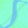
Carte topographique Pentha
Cliquez sur la carte pour afficher l’altitude.
À propos de cette carte

Nom : Carte topographique Pentha, altitude, relief.
Lieu : Pentha, Rajnagar, Kendrapara, Odisha, India (20.57994 86.84413 20.58004 86.84423)
Altitude moyenne : 2 m
Altitude minimum : -2 m
Altitude maximum : 7 m
Autres cartes topographiques
Cliquez sur une carte pour visualiser sa topographie, son altitude et son relief.



Abdul Kalam Island
In May 2013, increasing concern has been drawn to the change of the island's topography, owing to sand erosion. Since the island is technically a shoal, seawater frequently causes sand-shifting. The DRDO sought the assistance of geological experts from National Institute of Ocean Technology to monitor the…
Altitude moyenne : 1 m