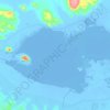
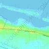
Carte topographique Qattara Depression
Cliquez sur la carte pour afficher l’altitude.
Qattara Depression
The Qattara Depression contains the second lowest point in Africa at an elevation of 133 metres (436 ft) below sea level, the lowest point being Lake Assal in Djibouti. The depression covers about 19,605 square kilometres (7,570 sq mi), a size comparable with Lake Ontario or twice as large as Lebanon. Due to its size and proximity to the shores of the Mediterranean Sea, studies have been made proposing to flood the area for various usages, such as the potential to generate hydroelectricity there.
À propos de cette carte

Nom : Carte topographique Qattara Depression, altitude, relief.
Lieu : Qattara Depression, Matruh, Egypt (29.99000 27.49000 30.01000 27.51000)
Altitude moyenne : -75 m
Altitude minimum : -78 m
Altitude maximum : -72 m
Autres cartes topographiques
Cliquez sur une carte pour visualiser sa topographie, son altitude et son relief.