Géolocaliser

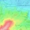
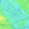
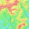
Carte topographique Tooting

Cliquez sur la carte pour afficher l’altitude.

À propos de cette carte

Nom : Carte topographique Tooting, altitude, relief.

Lieu : Tooting, London, Greater London, England, SW17 0TF, United Kingdom (51.38782 -0.20797 51.46782 -0.12797)

Altitude moyenne : 30 m

Altitude minimum : 0 m

Altitude maximum : 100 m

Autres cartes topographiques

Cliquez sur une carte pour visualiser sa topographie, son altitude et son relief.
London

United Kingdom > England > London

Altitude moyenne : 77 m

Plumstead Common

United Kingdom > England > London

Altitude moyenne : 44 m

Hampstead Heath

United Kingdom > England > London

Altitude moyenne : 94 m

Hackney Marshes

United Kingdom > England > London

Altitude moyenne : 10 m

Pool River

United Kingdom > England > London

Altitude moyenne : 36 m

London

United Kingdom > England > London

Altitude moyenne : 21 m

Soho Square

United Kingdom > England > London > Islington

Altitude moyenne : 28 m

Kensington Gardens

United Kingdom > England > London

Altitude moyenne : 25 m

Hampstead No. 1 Pond

United Kingdom > England > London

Altitude moyenne : 81 m

Harmondsworth Moor

United Kingdom > England > London

Altitude moyenne : 26 m

Équipez-vous pour votre prochaine aventure :

🧭Boussoles robustes - Navigation résistante conditions extrêmes
🗺️Cartes topographiques - Cartes détaillées pour randonnée, exploration et orientation
👣Semelles de Confort - Amorti supplémentaire pour vos longues explorations topographiques.
👖Pantalon de Marche - Pantalon transformable en short pour s'adapter au climat.
🧦Chaussettes mérinos - Isolation naturelle et respirante

En tant que Partenaire Amazon, ce site perçoit une commission sur les achats éligibles sans surcoût pour vous.