
Faire un don
Équipez-vous pour votre prochaine aventure :
En tant que Partenaire Amazon, ce site perçoit une commission sur les achats éligibles sans surcoût pour vous.
Carte topographique Brazos Bend State Park
Cliquez sur la carte pour afficher l’altitude.
Faire un don
Équipez-vous pour votre prochaine aventure :
En tant que Partenaire Amazon, ce site perçoit une commission sur les achats éligibles sans surcoût pour vous.
Brazos Bend State Park
Brazos Bend State Park occupies land bordering the Brazos River and includes within its boundaries low-lying areas left over from the River's previous meanderings. Pre-Columbian inhabitants included a series of Native American groups, most notably the Karankawa. The land passed through a variety of landowners' hands, resulting in some of the existing structures on the park grounds, including a brick cistern. The park's current nature center is built into a structure previously utilized as a hunting cabin. Over the years, improvements were made to the various water bodies in the park for both recreational and flood management purposes. A low-elevation levied walkway surrounds the perimeter of some of the larger water bodies (Elm Lake, 40 Acre Lake, etc.). While significant modifications were made to the land within the park in the past, the current management strategy is to allow, in balance with the recreational elements of the park's mission, the maintenance of a natural landscape. In 1984 the park was officially opened to the public, its lands having been donated to the state several years previously. In 2009, the park celebrated its 25th anniversary with a variety of special events and recognitions. Today the park is run by the Texas Parks and Wildlife Department, with the assistance of an active non-profit volunteer organization.
Faire un don
Équipez-vous pour votre prochaine aventure :
En tant que Partenaire Amazon, ce site perçoit une commission sur les achats éligibles sans surcoût pour vous.
À propos de cette carte
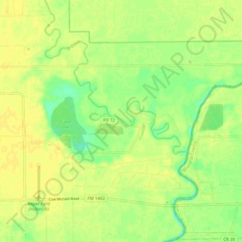
Nom : Carte topographique Brazos Bend State Park, altitude, relief.
Altitude moyenne : 17 m
Altitude minimum : 4 m
Altitude maximum : 24 m
Faire un don
Équipez-vous pour votre prochaine aventure :
En tant que Partenaire Amazon, ce site perçoit une commission sur les achats éligibles sans surcoût pour vous.