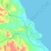
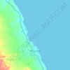
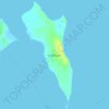
Carte topographique Gabal Elba
Cliquez sur la carte pour afficher l’altitude.
Gabal Elba
In the higher-elevation mist zone, species of acacia, Moringa and Gabal Elba dragon tree (Dracaena ombet) form the woodland tree canopy, with ferns, mosses and succulents in the understory. The mountain intercepts moisture-bearing winds from the northeast, and the northern and northeastern slopes are more humid than the western and southern slopes. Savannas of acacia and Delonix grow in the foothills and along watercourses. The mountain is home to the largest remaining population of Dracaena ombet in Egypt and Sudan.
À propos de cette carte

Nom : Carte topographique Gabal Elba, altitude, relief.
Lieu : Gabal Elba, Red Sea, Egypt (22.16785 36.36483 22.16795 36.36493)
Altitude moyenne : 1 004 m
Altitude minimum : 599 m
Altitude maximum : 1 412 m
Autres cartes topographiques
Cliquez sur une carte pour visualiser sa topographie, son altitude et son relief.