
Carte topographique Village of Falconer
Carte interactive
Cliquez sur la carte pour afficher l’altitude.
À propos de cette carte
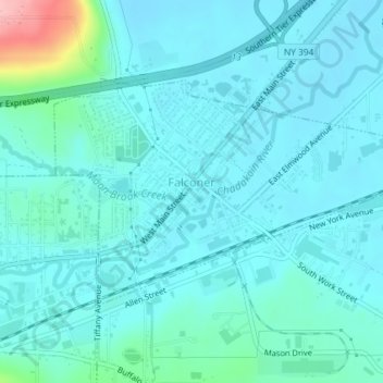
Nom : Carte topographique Village of Falconer, altitude, relief.
Altitude moyenne : 399 m
Altitude minimum : 378 m
Altitude maximum : 525 m
Autres cartes topographiques
Cliquez sur une carte pour visualiser sa topographie, son altitude et son relief.
Jamestown West
United States > New York > Chautauqua County > Town of Ellicott
Jamestown West, Town of Ellicott, Chautauqua County, New York, United States
Altitude moyenne : 441 m
Village of Celoron
United States > New York > Chautauqua County > Town of Ellicott
Village of Celoron, Town of Ellicott, Chautauqua County, New York, 14720, United States
Altitude moyenne : 410 m