
Carte topographique Turhal
Cliquez sur la carte pour afficher l’altitude.
Turhal
Turhal is a city in Tokat Province in the Black Sea region of Turkey. It is the seat of Turhal District. Its population is 62,030 (2022). It is 48 km to the west of Tokat. Turhal is situated on a fertile plain fragmented by the Yeşil Irmak river. It has an elevation of approximately 530 m. The city is best known for its sugar beet processing plant established in 1934 as an important enterprise of the young Turkish Republic.
À propos de cette carte
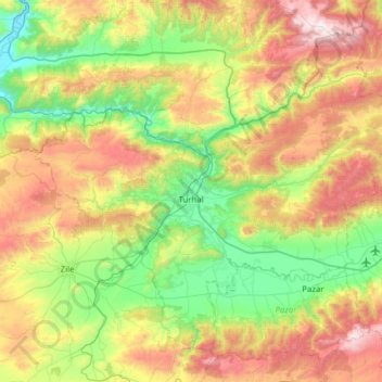
Nom : Carte topographique Turhal, altitude, relief.
Lieu : Turhal, Tokat, Black Sea Region, 60300, Turkey (40.20054 35.82604 40.59330 36.44766)
Altitude moyenne : 956 m
Altitude minimum : 400 m
Altitude maximum : 1 954 m
Autres cartes topographiques
Cliquez sur une carte pour visualiser sa topographie, son altitude et son relief.