
Carte topographique Daporijo
Carte interactive
Cliquez sur la carte pour afficher l’altitude.
À propos de cette carte
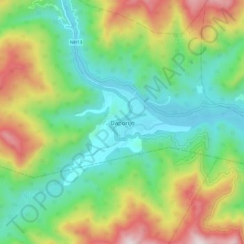
Nom : Carte topographique Daporijo, altitude, relief.
Altitude moyenne : 541 m
Altitude minimum : 216 m
Altitude maximum : 1 171 m
Daporijo is located at an elevation of 600 m above sea level. It is located beside the river Subansiri, one of the principal rivers of Arunachal Pradesh, and a major tributary of the mighty Brahmaputra Daporijo valley is surrounded by Evergreen hills in three corners and Subansiri river in the other.