
Faire un don
Équipez-vous pour votre prochaine aventure :
En tant que Partenaire Amazon, ce site perçoit une commission sur les achats éligibles sans surcoût pour vous.
Carte topographique Reitlehen
Cliquez sur la carte pour afficher l’altitude.
Faire un don
Équipez-vous pour votre prochaine aventure :
En tant que Partenaire Amazon, ce site perçoit une commission sur les achats éligibles sans surcoût pour vous.
À propos de cette carte
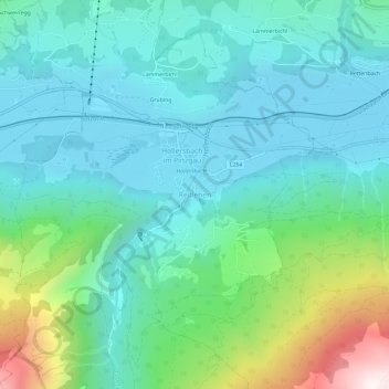
Nom : Carte topographique Reitlehen, altitude, relief.
Altitude moyenne : 1 046 m
Altitude minimum : 787 m
Altitude maximum : 1 967 m
Faire un don
Équipez-vous pour votre prochaine aventure :
En tant que Partenaire Amazon, ce site perçoit une commission sur les achats éligibles sans surcoût pour vous.
Autres cartes topographiques
Cliquez sur une carte pour visualiser sa topographie, son altitude et son relief.
Kaprun
Austria > Salzburg > Bezirk Zell am See
Kaprun (German pronunciation: [kaˈpruːn]) is a municipality in the Zell am See District in the province of Salzburg in Austria. Together with the neighboring city of Zell am See the town presents itself as the tourist destination and skiing area "Zell am See-Kaprun". Kaprun distinguishes itself from its…
Altitude moyenne : 1 819 m
Faire un don
Équipez-vous pour votre prochaine aventure :
En tant que Partenaire Amazon, ce site perçoit une commission sur les achats éligibles sans surcoût pour vous.
Neukirchen am Großvenediger
Austria > Salzburg > Bezirk Zell am See
Neukirchen am Großvenediger is a market town in the district of Zell am See (Pinzgau region), in the state of Salzburg in Austria. Neukirchen is at an altitude of 856 meters and its population (as of May 2001) is 2,616.
Altitude moyenne : 1 968 m
Faire un don
Équipez-vous pour votre prochaine aventure :
En tant que Partenaire Amazon, ce site perçoit une commission sur les achats éligibles sans surcoût pour vous.
Kaprun
Austria > Salzburg > Bezirk Zell am See
Kaprun (German pronunciation: [kaˈpruːn]) is a municipality in the Zell am See District in the province of Salzburg in Austria. Together with the neighboring city of Zell am See the town presents itself as the tourist destination and skiing area "Zell am See-Kaprun". Kaprun distinguishes itself from its…
Altitude moyenne : 1 819 m
Faire un don
Équipez-vous pour votre prochaine aventure :
En tant que Partenaire Amazon, ce site perçoit une commission sur les achats éligibles sans surcoût pour vous.
Zell am See
Austria > Salzburg > Bezirk Zell am See
Zell am See provides winter skiing on the above Schmittenhöhe mountain. The skiable area is approximately 138 km, including the pistes on the Kitzsteinhorn and Kaprun Maiskogel. The ski pass covers the whole area including transport to and from the glacier which is open most of the year, dependent on…
Altitude moyenne : 1 118 m
Mittersill
Austria > Salzburg > Bezirk Zell am See
It has traffic links running east to west and north to south. The Felbertauern road tunnel runs south through the Hohe Tauern at an elevation of about 1630 m, providing a connection with Lienz in East Tyrol. To the north lies the Thurn Pass at an elevation of 1274 m, providing a connection with Kitzbühel and…
Altitude moyenne : 1 729 m
Bruck an der Großglocknerstraße
Austria > Salzburg > Bezirk Zell am See
The Grossglockner High Alpine Road, as a high-altitude mountain road, connects the two Austrian provinces of Salzburg and Carinthia. The span from Bruck to Heiligenblut along the road is 47.8 kilometres (29.7 mi) long. At Bruck-Fusch station the municipality has access to the Salzburg-Tyrol Railway line.
Altitude moyenne : 1 155 m
Faire un don
Équipez-vous pour votre prochaine aventure :
En tant que Partenaire Amazon, ce site perçoit une commission sur les achats éligibles sans surcoût pour vous.
Krimml
Austria > Salzburg > Bezirk Zell am See
Krimml is situated on the Salzach river, at the southwestern rim of the upper (western) Pinzgau region near the border with Tyrol. It is located about 54 km (34 mi) west of the town of Mittersill and 54 km (34 mi) from the district capital Zell am See. The settlement's centre area is situated at an elevation…
Altitude moyenne : 2 141 m
Faire un don
Équipez-vous pour votre prochaine aventure :
En tant que Partenaire Amazon, ce site perçoit une commission sur les achats éligibles sans surcoût pour vous.
Neukirchen am Großvenediger
Austria > Salzburg > Bezirk Zell am See
Neukirchen am Großvenediger is a market town in the district of Zell am See (Pinzgau region), in the state of Salzburg in Austria. Neukirchen is at an altitude of 856 meters and its population (as of May 2001) is 2,616.
Altitude moyenne : 1 968 m
Obersulzbachkees
Austria > Salzburg > Bezirk Zell am See > Marktgemeinde Neukirchen am Großvenediger
Altitude moyenne : 2 757 m
Viehhofen
Austria > Salzburg > Bezirk Zell am See
The town lies at an elevation of 856 m above sea level in the middle of Glemmtal Valley, through which flows the River Saalach. The valley's main town is our western neighbor, Saalbach-Hinterglemm. To the east, at the entrance to the valley, you will find the village of Maishofen.
Altitude moyenne : 1 376 m