
Carte topographique Nixa
Carte interactive
Cliquez sur la carte pour afficher l’altitude.
À propos de cette carte
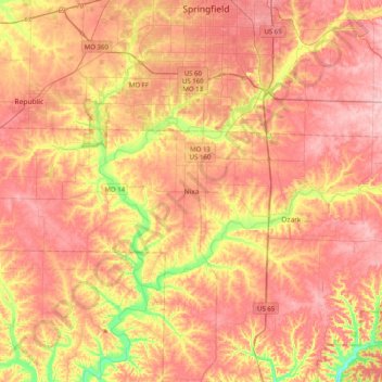
Nom : Carte topographique Nixa, altitude, relief.
Lieu : Nixa, Christian County, Missouri, 65714, United States (36.88394 -93.46985 37.20394 -93.14985)
Altitude moyenne : 383 m
Altitude minimum : 287 m
Altitude maximum : 443 m
Nixa Public Schools operates four elementary schools for students in kindergarten through fourth grade: Helen-Matthews Elementary, Espy Elementary, Century Elementary, and the newest, High Pointe Elementary (named because it sits on the highest elevation in Christian County), opened in August 2007. Two intermediate schools serve students in the fifth and sixth grades: Inman Intermediate and Summit Intermediate. One junior high school, Nixa Junior High, and one high school, Nixa Public High School are in the district. A magnet school, John Thomas School of Discovery, hosts kindergarten through 6th grade.