
Carte topographique Village of Hoosick Falls
Carte interactive
Cliquez sur la carte pour afficher l’altitude.
À propos de cette carte
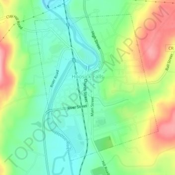
Nom : Carte topographique Village of Hoosick Falls, altitude, relief.
Altitude moyenne : 166 m
Altitude minimum : 115 m
Altitude maximum : 249 m
Autres cartes topographiques
Cliquez sur une carte pour visualiser sa topographie, son altitude et son relief.
Eagle Bridge
United States > New York > Rensselaer County > Town of Hoosick
Eagle Bridge, Town of Hoosick, Rensselaer County, New York, 12028, United States
Altitude moyenne : 161 m
Walloomsac Dam
United States > New York > Rensselaer County > Town of Hoosick > Walloomsac
Walloomsac Dam, Walloomsac, Town of Hoosick, Rensselaer County, New York, 12133, United States
Altitude moyenne : 191 m