
Carte topographique 'Amanave
Carte interactive
Cliquez sur la carte pour afficher l’altitude.
À propos de cette carte
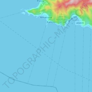
Nom : Carte topographique 'Amanave, altitude, relief.
Altitude moyenne : 23 m
Altitude minimum : 0 m
Altitude maximum : 372 m
'Amanave was severely damaged by the 2009 tsunami. However, of a population of about 500 residents, no deaths were recorded. When the tsunami approached, emergency information was sent by radio and a bell rang in the village. After the tsunami, some residents followed the advice of the Federal Emergency Management Agency (FEMA) and moved into houses on a higher elevation.