
Carte topographique Miguel Esteban
Carte interactive
Cliquez sur la carte pour afficher l’altitude.
À propos de cette carte
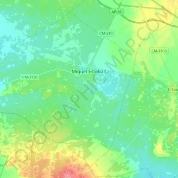
Nom : Carte topographique Miguel Esteban, altitude, relief.
Altitude moyenne : 687 m
Altitude minimum : 663 m
Altitude maximum : 750 m
Autres cartes topographiques
Cliquez sur une carte pour visualiser sa topographie, son altitude et son relief.
Dorada
España > Castilla-La Mancha > Miguel Esteban
Dorada, Miguel Esteban, Castilla-La Mancha, España
Altitude moyenne : 674 m