
Carte topographique Thavinhal
Carte interactive
Cliquez sur la carte pour afficher l’altitude.
À propos de cette carte
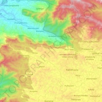
Nom : Carte topographique Thavinhal, altitude, relief.
Lieu : Thavinhal, Boy's Town, Mananthavady, Wayanad, Kerala, India (11.77066 75.79000 11.90304 75.98233)
Altitude moyenne : 690 m
Altitude minimum : 71 m
Altitude maximum : 1 469 m