

Carte topographique Stone
Cliquez sur la carte pour afficher l’altitude.
Stone
More recent research points to older, though no less interesting nor tangible, possibilities regarding its name and founding. Around Stone lie several Romano-British sites and it is not inconceivable that the name alludes to the stone remains of a bridge or milestone, perhaps continuing the Roman road from Rocester to Blythe Bridge and then potentially through Stone. The settlement of Walton (which now forms a suburb) is ancient Brythonic (Celtic/ancient Briton place name). The most likely derivation for most places called Stone is from a prehistoric megalith, Roman milestone, a natural boulder or rock formation, or from 'a place where stone was obtained'. A Keuper sandstone outcrop on the north side of Stone, long quarried for building materials, may be the topographical feature from which the place was named. It may also be noted that a huge stone or erratic is recorded on Common Plot and in that respect it is unclear whether Stone Field here, one of the open-fields of Stone, is 'the field at Stone' or 'the field with the stone'.
À propos de cette carte

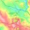
Nom : Carte topographique Stone, altitude, relief.
Lieu : Stone, Stafford, Staffordshire, England, United Kingdom (52.87945 -2.16587 52.91551 -2.11471)
Altitude moyenne : 107 m
Altitude minimum : 80 m
Altitude maximum : 164 m
Autres cartes topographiques
Cliquez sur une carte pour visualiser sa topographie, son altitude et son relief.
Kingsley Holt
United Kingdom > England > Staffordshire > Staffordshire Moorlands
Altitude moyenne : 184 m
Crackley
United Kingdom > England > Staffordshire > Newcastle-under-Lyme > Chesterton
Altitude moyenne : 166 m
Gratwich
United Kingdom > England > Staffordshire > East Staffordshire > Kingstone
Altitude moyenne : 143 m
Swan Bank
United Kingdom > England > Staffordshire > Newcastle-under-Lyme > Madeley > Swan Bank
Altitude moyenne : 135 m