
Carte topographique Wolstanton Marsh
Carte interactive
Cliquez sur la carte pour afficher l’altitude.
À propos de cette carte
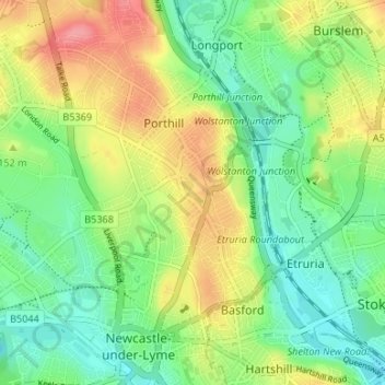
Nom : Carte topographique Wolstanton Marsh, altitude, relief.
Altitude moyenne : 143 m
Altitude minimum : 111 m
Altitude maximum : 191 m
Autres cartes topographiques
Cliquez sur une carte pour visualiser sa topographie, son altitude et son relief.
Betley Mere
United Kingdom > England > Staffordshire > Borough of Newcastle-under-Lyme > Wrinehill > Cracow Moss
Altitude moyenne : 81 m