
Carte topographique Ness
Cliquez sur la carte pour afficher l’altitude.
À propos de cette carte
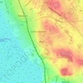
Nom : Carte topographique Ness, altitude, relief.
Altitude moyenne : 34 m
Altitude minimum : -1 m
Altitude maximum : 75 m
Autres cartes topographiques
Cliquez sur une carte pour visualiser sa topographie, son altitude et son relief.
Wirral Country Park
United Kingdom > England > Cheshire West and Chester > Neston > Windle Hill
Altitude moyenne : 49 m
Ness Wood
United Kingdom > England > Cheshire West and Chester > Neston > Ness
Altitude moyenne : 53 m