
Carte topographique Raleigh
Carte interactive
Cliquez sur la carte pour afficher l’altitude.
À propos de cette carte
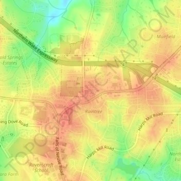
Nom : Carte topographique Raleigh, altitude, relief.
Altitude moyenne : 126 m
Altitude minimum : 93 m
Altitude maximum : 143 m
Autres cartes topographiques
Cliquez sur une carte pour visualiser sa topographie, son altitude et son relief.
Wake Forest
United States > North Carolina > Wake County
Wake Forest is located in the northeast-central region of North Carolina, where the North American Piedmont and Atlantic Coastal Plain regions meet. This area is known as the "Fall Line" because it marks the elevation inland at which waterfalls begin to appear in creeks and rivers. Its central Piedmont…
Altitude moyenne : 105 m